|
John Day Fossil Beds Historic Resources Study |

|
Chapter Eight:
TOURISM AND RECREATION (continued)
Three State Parks and a National Monument
In 1921, the Oregon legislature authorized the Highway Commission to acquire rights-of-way to 300 feet on either side of the centerline of Oregon roads. Under this authority the Commission began acquiring small parks and waysides. From this modest beginning, gifts of land and purchases of property led to a network of roadside parks. In 1925, the Oregon legislature expanded the authority of the Highway Commission to acquire larger areas for the preservation of trees and scenic places for "parks, parking places, camp sites, public squares and recreation grounds." The Commission was empowered to improve, maintain, and supervise these properties (Armstrong 1965: 13-14; Merriam and Talbot 1992:17-20).
Samuel H. Boardman became Superintendent of Oregon State Parks in 1929. Long impressed and inspired by lands in the John Day watershed, Boardman began the acquisition of scenic and paleontological areas there, but the project was slowed by the onset of the Depression. In 1942, the Oregon State Board of Higher Education, responding to the impetus of paleontologist John C. Merriam, created an Advisory Committee on State Parks. The aim of Merriam and the Advisory Committee was to secure key acreage in Grant and Wheeler counties. Although the committee did not endure, its purposes were attained when, in 1947, the State of Oregon had assembled sufficient lands to create the two new state parks — Painted Hills State Park, and Thomas Condon John Day Fossil Beds State Park (Merriam and Talbot 1992: 264).

Fig. 67. Tourists in the Painted Hills
Unit, ca. 1955, John Day Fossil Beds National Monument (OrHi ODOT
5237).
The following table identifies initial tracts acquired by the Oregon Highway Commission as it built up acreage in the vicinity of the Fossil Beds. Acquisition was by both gifted deed and purchase. Boardman himself recommended a number of the properties. Some parcels were selected based upon scenic values; others were selected because of their geological or paleontological importance (Langille 1948a: 2). By 1965, the State opened for public use a third new park in the area — Clarno State Park.
Table 6. Some Lands Acquired for State Parks at John Day Fossil Beds
| Milepost | Acres | Location | Name | Date |
THOMAS CONDON-JOHN DAY FOSSIL BEDS STATE PARK: | ||||
| MP 106 | 3 | T9S, R26E, Sec. 31 | Griffin Tract | 6/18/1945 |
| MP 116 | 40 | T11S, R26E, Sec. 7 | The Cathedral | 6/20/1939 |
| MP 116.67 | .79 | T11S, R26E, Secs. 7,18 | Johnny Kirk Springs | 8/4/1928 |
| MP 118 | 200 | T22S, R26E, Secs. 28-29 | Turtle Cove | 1/5/1939 |
| MP 120 | 40 | T11S, R26E, Sec. 32 | Kennedy Tract | 7/17/1945 |
| MP 121 | 4.8 | T12S, R26E, Sec. 6 | Cant Wayside | 9/14/1935 |
| MP 122-123 | - | - | Sheep Rock | |
| MP 124 | - | - | Rock Creek Tract | |
| MP 125 | 1602 | T12S, R25E, Secs. 1, 2 T12S, R26E, Secs. 5, 8,18, 20 | Picture Gorge | 5/20/1931 |
| MP 126.7 | 3.8 | T12S, R26E, Sec. 29 | William Mascall Overlook | 9/14/1935 |
| MP 136 | 1.5 | T13S, R29E, Sec. 7 | Van Horn Ranch | 1/31/1931 |
PAINTED HILLS STATE PARK: | ||||
| - | 13.2 | T10S, R21E, Sec. 31, SE 1/4 | Allen Ranch | 6/23/1947 |
(Erigero 1995; Langille 1948b: 1-2). | ||||
Overall, the investments of Oregon Highway Commission in the John Day Fossil Beds parks were modest. They included a textboard, tables, benches, stoves, and an entrance road at Painted Hills State Park and at Thomas Condon John Day Fossil Beds State Park; an entrance road and parking area at Mascall Overlook; limited camping facilities at Turtle Cove; and a wayside with a textboard two miles north of the junction of Highways 26 and 19. Visitation was not carefully tracked. In 1962, Painted Hills State Park drew 5,703 visitors; no record was kept in 1963. For the Thomas Condon-John Day Fossil Beds State Park, no visitor count was made (Armstrong 1965:171, 206-207, 254, 257).

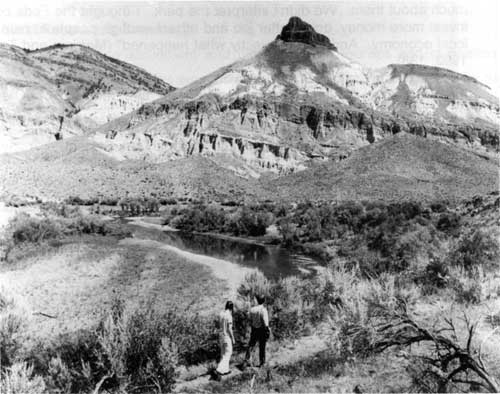
Fig. 68. Hikers on John Day River at
Sheep Rock, John Day Fossil Beds National Monument (OrHi
86137).
David G. Talbot, retired Superintendent of Oregon State Parks, recalled the sustained efforts of Gordon Glass, a resident of John Day, to lift up public attention and use of the fossil beds area: "Let's do something magnificent with the Painted Hills and Fossil Beds in the John Day River country because people come from miles around to see these scenic formations and it will help local business," he said. Talbot continued:
I could see right away that here was an opportunity to upgrade the presentation of those features. Because they are of national significance scientifically, maybe we could get the National Park Service to take them on. For a variety of reasons, we were not doing a very good job with the areas as a state park. We protected the holdings, but we didn't tell visitors much about them. We didn't interpret the park. I thought the Feds could invest more money, do a better job and attract enough people to help the local economy. And, that is exactly what happened" (Merriam and Talbot 1992: 138).
In 1967, the National Park Service, at the request of Oregon Congressman Al Ullman, conducted a regional study to evaluate the feasibility of including Oregon State Parks lands within the National Park System.
Table 7. Units Studied by National Park Service, 1967
| Unit | Acreage |
| Sheep Rock | 3,965 |
| Turtle cove | 240 |
| Foree | 80 |
| The Cathedral | 40 |
| William Mascall Overlook | 2 |
| Davis Dike | 20 |
| Clarno State Park | 120 |
| Painted Hills State Park | 13.2 |
(National Park Service 1967: 6-11) | |
The 1967 National Park Service assessment found colorful, scenic resources, limited recreation facilities, incomplete archaeological information, and historic resources "primarily of State or local significance." The Park Service determined that the areas examined were suitable for establishment as a national monument, but not for inclusion in the National Park System. The study concluded: "Of the natural, scientific, and recreational resources within the area of study, those of paramount importance are scientific." (National Park Service 1967: 24-28).

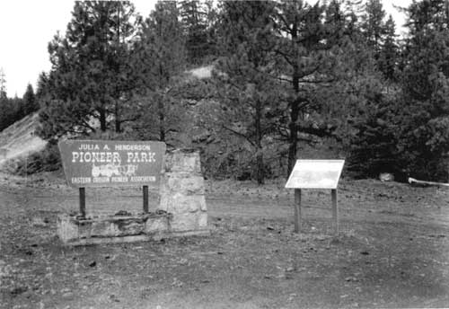
Fig. 69. Julia A. Henderson Pioneer
Park. F.K. Lentz, 1996 (National Park Service)
| <<< Previous | <<< Contents >>> | Next >>> |
joda/hrs/hrs8b.htm
Last Updated: 25-Apr-2002